|
Basic NavigationSM |
||||||||||||||||
|
Students Per Instructor: 1, 2 or 3
Course Summary: This course will teach you how to use traditional navigation tools and techniques to plan outdoor adventures, keep track of your whereabouts, and facilitate accurate routefinding. Straightforward methods for using map, compass and altimeter in the real world are taught. Every outdoor enthusiast should have the skills we present in this course, especially people who venture off marked trails. |
||||||||||||||||
|
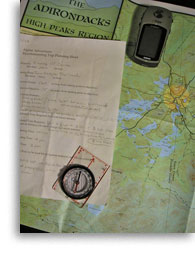
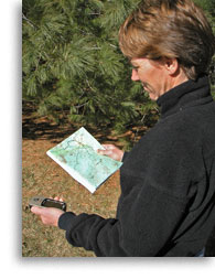
Course Description: We begin instruction by introducing the concepts of area, line and point position, and how they clarify navigational requirements in different situations. Next, we’ll introduce topographic map usage including coordinate systems, scale, the various symbols commonly used, and how to determine elevation using contour lines. We explain the practical differences between true north, magnetic north and grid north and how to account for them as you navigate with different tools and methods. Once you clearly understand this “big picture” we introduce the one tool you should always carry; the compass. We teach practical techniques for using this essential tool, which does much more than just point north. You will learn to take and plot bearings in the field, and on a map; and how to account for magnetic declination. We teach you how to travel in a straight line and how to estimate distance by pacing. We will also help you determine when precision compass navigation is essential and when it amounts to overkill. After your compass skills come together we introduce the altimeter, a tool that is often more useful in mountain terrain. We explain to how to calibrate and use this tool, and how to work within its limitations. Finally, we will pull out a GPS unit and show you how navigating with absolute position makes traditional methods seem almost arcane. We will also remind you that a GPS unit that can’t lock onto a satellite, due to foliage or other interference (or dead batteries), is useless. We cover the basics of using GPS in the field in this course. Our Advanced Navigation course will teach you how to integrate GPS with other technologies to take trip planning and routefinding into another realm. This is not an orienteering course. Skills taught are intended for practical application on outdoor adventures, where navigation is a means, not an end. Most of the skills we teach are introduced in our classroom; all are practiced and refined on terrain without trails. If your outdoor adventures take you to wild places, away from marked trails, you need basic navigation skills. The first time you find yourself on featureless terrain, in bad visibility, you will realize just how critical these skills can be. Learning these skills before this happens might just save your hide. |

|
||||||||||||||||
|
~ Mountain Adventures In the Adirondacks Since 1985 ~ |
|||
|
Alpine Adventures, Inc. |
(518) 576-9881 |
||


